Dry Falls, Washington: Once the World’s Largest Waterfall
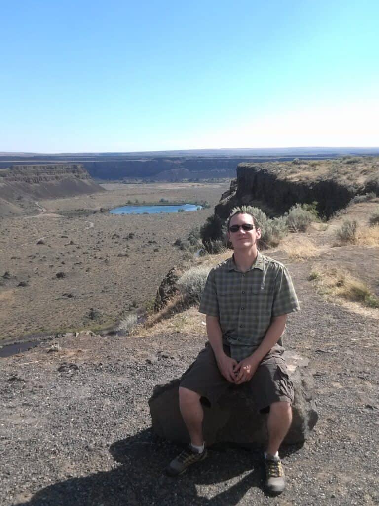
When we arrived at Dry Falls and took our first steps out of the car, I think we all were surprised at how neat it was. We had hoped for something cool, but this was better than expected, considering none of the Washingtonians had ever heard of this place before!
Dry Falls used to be the world’s largest waterfall which would have made Niagara Falls look small. It was formed by Ice Age floods but has now left behind a mostly dry canyon.
Our quick guide shares what we learned about how Dry Falls was formed and what there is to do when you visit so you can get the most out of a stop here.
DISCLAIMER: Never Stop Adventuring contains links to affiliate websites and is a member of the Amazon Services LLC Associates Program. When you click on and/or make a purchase through an affiliate link placed on our website, we may receive a small commission or other form of compensation at no additional cost to you. Please read our disclaimer for more info.

How Was Dry Falls Formed?
At first glance, you might think that the Dry Falls area was formed like the Grand Canyon, with a previously existing river carving the canyon deeper and deeper as it flows through over the years. This wasn’t the case here.
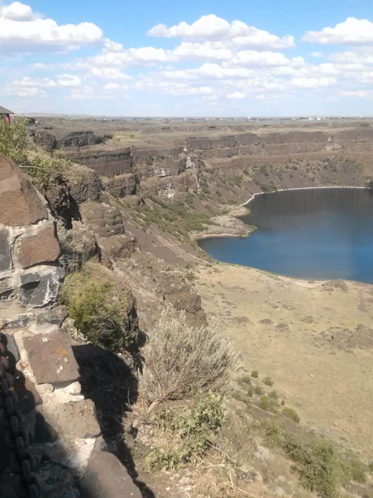
Instead, it was created as Ice Age floods ripped through the area, in which the Dry Falls would have been multiple times the size of Niagara Falls in both width and height as the water plunged over the ~400 foot tall cliffs.
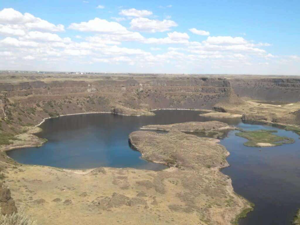
The volcanic rock, which already had conveniently formed cracks, was swept away in the flooding, enlarging the canyon. On the floor of the canyon, there are large round depressions, which were formed as the water and the rocks it carried swirled and carved these bowl shaped imprints.
Even more interestingly, if you were to follow the course the flood waters took, where the canyon opens into the flat lands, you would find the rocks that were carried by the flood waters. They were finally deposited, but some of the rocks were buried up to 160 feet deep (if we are remembering the park video correctly)!
What To Do At Dry Falls
Dry Falls Visitor Center
Dry Falls visitor center and parking are free to use. Once inside, the park video is surprisingly good so we recommend you watch this one.
The visitor center has exhibits on the Ice Age flooding, area geology, and human history of the region. There are also some large glass windows that provide another clear view of Dry Falls.
The visitor center will be closing from November 1, 2025, to August 1, 2026 for renovation.
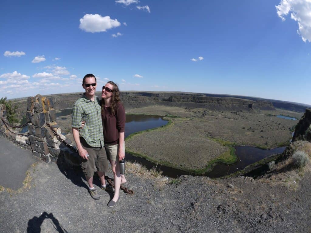
Dry Falls Vista House & Overlook
On the other end of the parking lot is a small historic stone structure. This is the vista house and a cute covered area to check out Dry Falls.
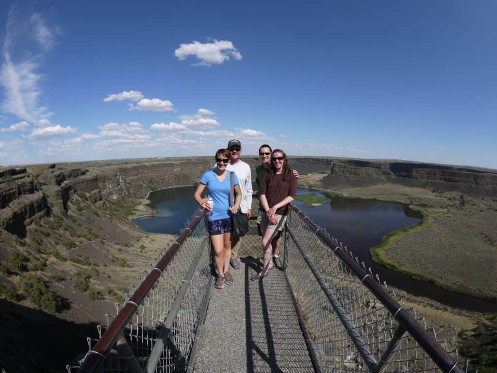
Immediately in front of it is the small overlook bridge. This little walkway over the edge will give you the closest look of the area.
It’s also the best place for a picture, especially if you have a wide angle lens and can capture both your group and the entire canyon behind you.
This was definitely a worthy stop that we highly recommend!
What To See Next
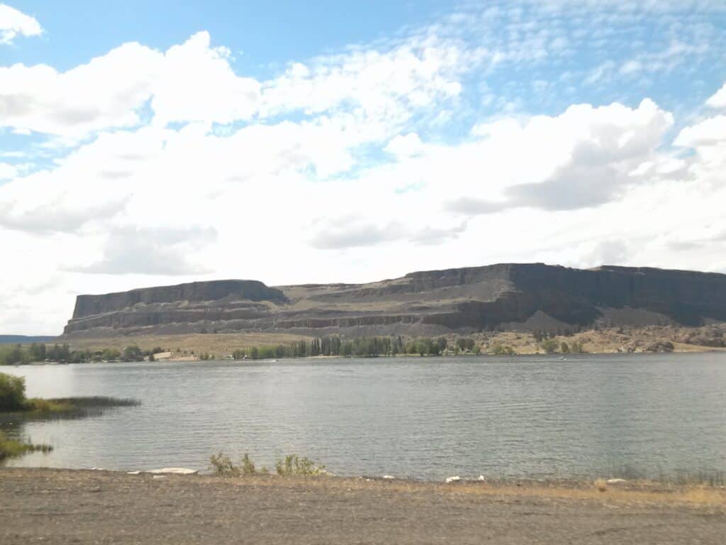
Within half an hour drive north along the length of Banks Lake you can reach Steamboat Rock State Park. Steamboat Rock itself sits out in the lake towering over the landscape. The scenery along this drive with imposing cliffs along the roadside is gorgeous.
Just a bit past that is the Grand Coulee Dam with free tours and even an evening laser light show on the dam.