Mount Blue Sky: A Colorado High Altitude Adventure
Mount Blue Sky, previously known as Mount Evans, is one of Colorado’s 14ers, a mountain over 14,000 feet tall (14,265 feet). Usually getting to the top of a 14er is reserved for those willing to make the trek on foot to the top.
But not necessarily so with Mount Blue Sky. The Mount Blue Sky Scenic Byway, formerly known as the Mount Evans Scenic Byway, is the highest paved road in North America. You can drive to the parking lot near the summit.
While it is currently closed for the 2025 season for road construction, get all the details to plan your 2026 visit and make sure you’re ready to go. Here’s how!
DISCLAIMER: Never Stop Adventuring contains links to affiliate websites and is a member of the Amazon Services LLC Associates Program. When you click on and/or make a purchase through an affiliate link placed on our website, we may receive a small commission or other form of compensation at no additional cost to you. Please read our disclaimer for more info.

The Basics
- Who: Going to the top via car is possible for just about anyone, but know and be alert to effects of altitude and be smart about going back down to a lower elevation. Watch out for storms rolling in – lightning is a real danger. And make sure you have extra layers; it can be very cold and windy up there even if it’s super warm down in Denver at the same time.
- What: a 14,265 foot tall mountain that you can drive to the top of and walk a bit more to the summit with other interesting stops along the way.
- Where: West of Denver on I-70, take exit 240 in Idaho Springs. When you get to Echo Lake Park take a right onto the byway.
- When: Double check that the road is open all the way to the top as it is closed in winter.
- Why: Easy access to an altitude and scenery that is otherwise harder to come by.
- How: Drive your vehicle to the top with a reservation and entrance ticket. Please stay on your side of the road and be cautious! You could alternatively ride your bike (yes, we saw some very in shape folks doing this) or do some research and plan to climb it instead or hike part of the way from Summit Lake.
Reservations and Tickets
You’ll need to make a reservation to visit Mount Blue Sky. You can make a timed reservation online in advance, but not at the entrance station. Definitely do this ahead of time as you won’t have internet connectivity once you get out there.
If you have a National Parks pass, you won’t have an additional entrance fee but you still need to make a reservation and pay the reservation fee of $2.
For a ticket to the summit and including all of the recreation sites along the way it is $15 per vehicle. You can buy a ticket for only $10 if you don’t plan to stop
The Drive
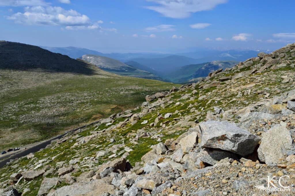
Roads are windy and narrow, and where you’d expect guardrails you won’t see any, so it’s definitely a road on which to take your time and be cautious. It’s outrageously scenic all the way up this 28 mile road as you ascend over 7,000 feet of elevation change.
Stops Along The Way
Echo Lake is great for a picnic, fishing, or hiking. You’ll reach this parking lot before the Mount Blue Sky Scenic Byway entrance station. You can take a paved trail around the lake and picnic area.
Further up, stop at the Mount Goliath Nature Center to see the alpine garden and various exhibits. From here you can take a short hike to see Rocky Mountain bristlecone pine on the quarter mile Bristlecone Loop Trail.
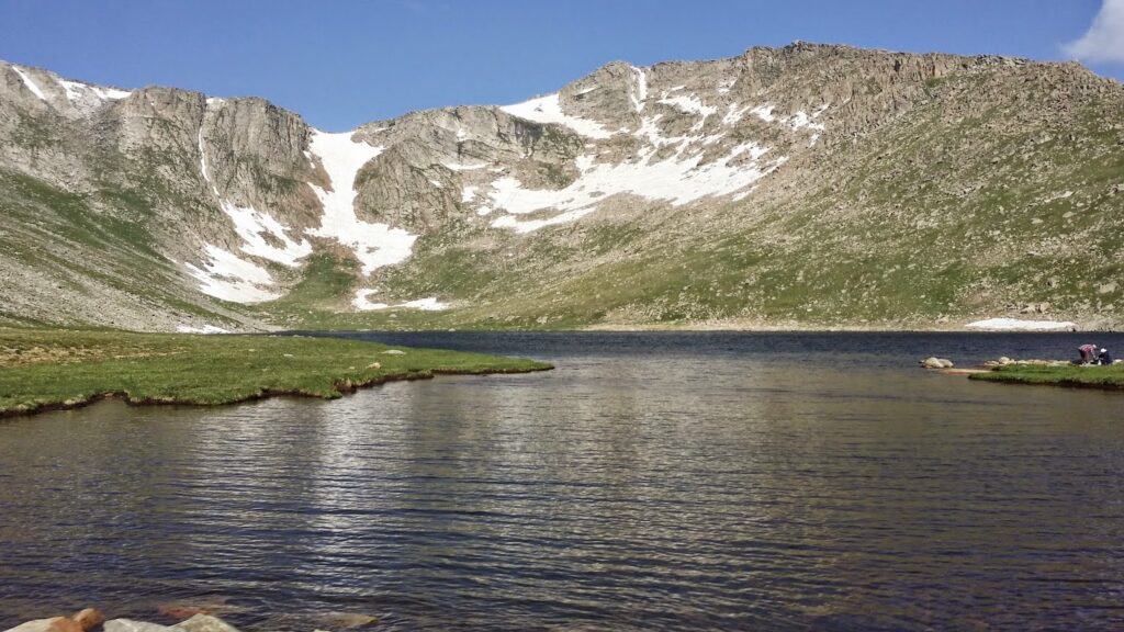
Summit Lake Park, at 12,830 feet, is known for the arctic tundra visible here. I thought it was incredible that for some of the alpine-arctic plants that grow here the only other place you’ll find them is above the Arctic Circle. There is a short half mile trail that will take you to the Chicago Lakes Overlook on which you can also take a stroller.
The Summit
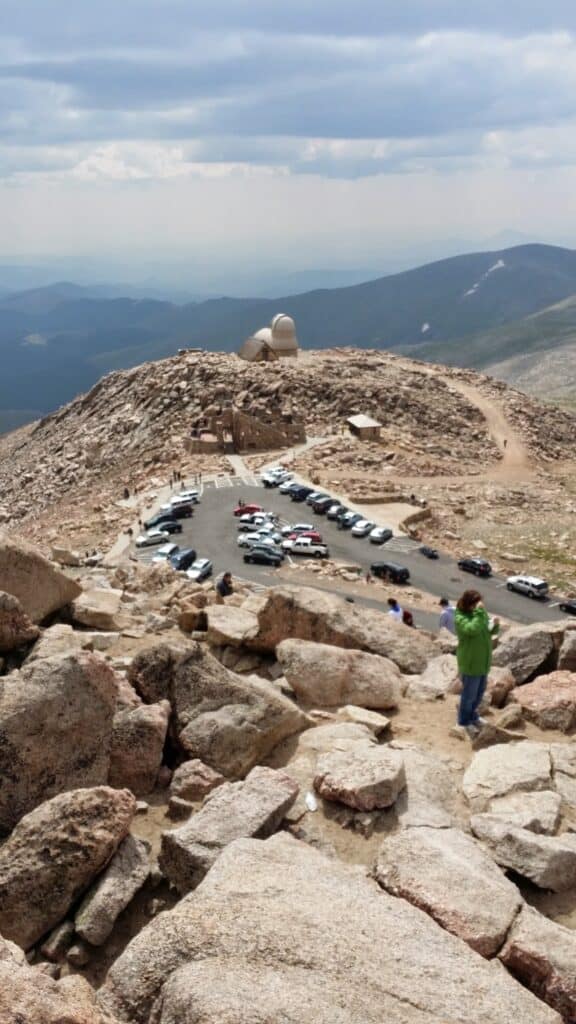
Once you reach the parking lot at the top of Mount Blue Sky, also known as the Summit Interpretive Area, you’ll see several buildings. There are the ruins of the Crest House, which was a restaurant and gift shop from the 40’s that burnt down in 1979.
You’ll also see the Mount Blue Sky Field Station which researchers and academic groups can use and the Meyer-Womble Observatory.
Then it’s actually a short walk up a switchback trail to the summit. It is well worth it but take your time as the altitude difference is immense and you are bound to feel it. Both of us felt a little lightheaded. We were really excited to check this out with our friends a second time, and even being from Indiana they handled the elevation well.
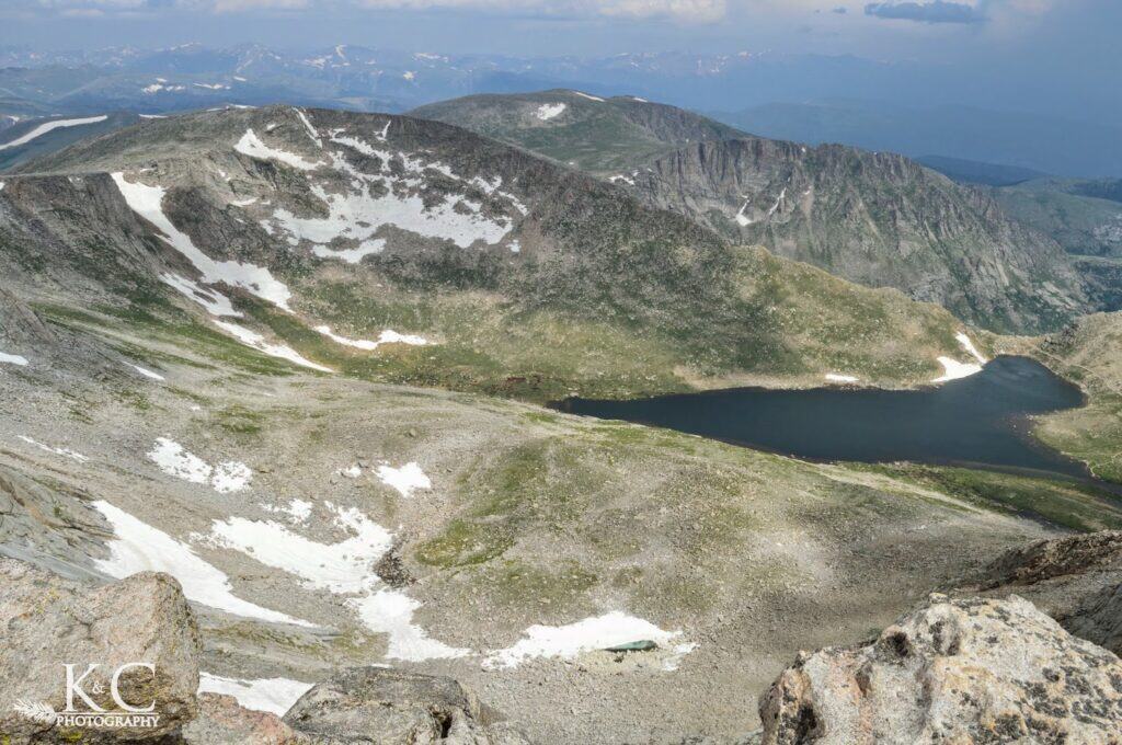
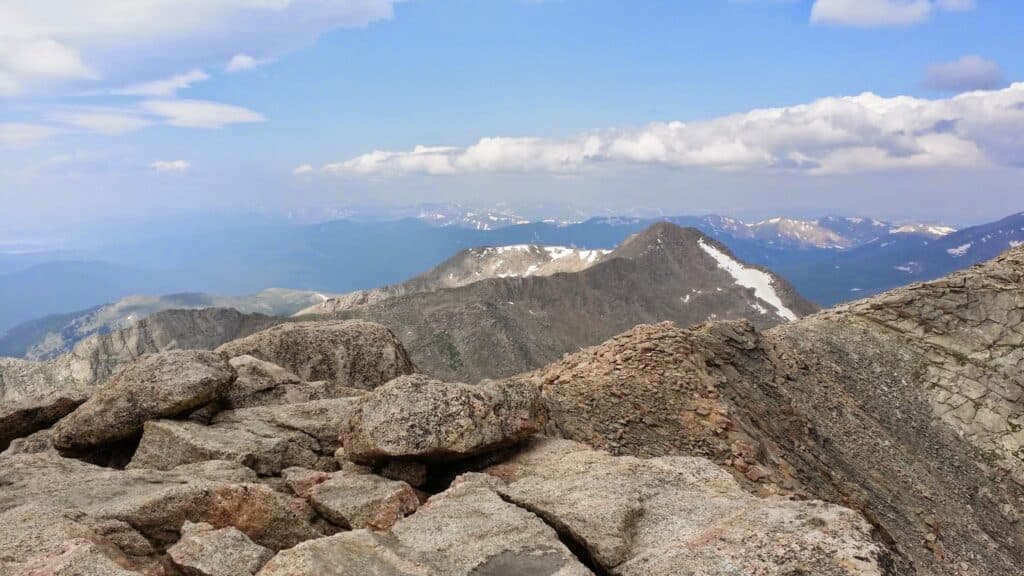
There are amazing views in every direction of the Rocky Mountain Front Range and Continental Divide. You’ll see other mountains in the distance and picturesque alpine lakes below.
The Wildlife
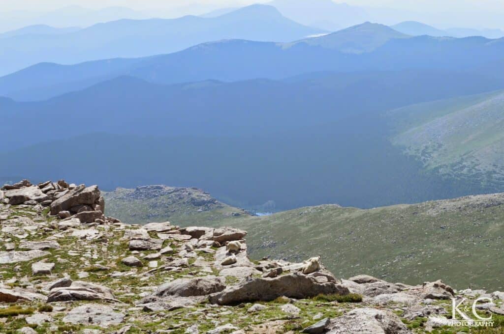
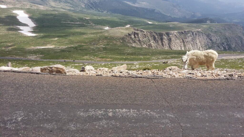
If you keep your eyes peeled you may even see various wildlife. You can expect to potentially see animals such as various birds, marmots, mountain goats, and bighorn sheep.

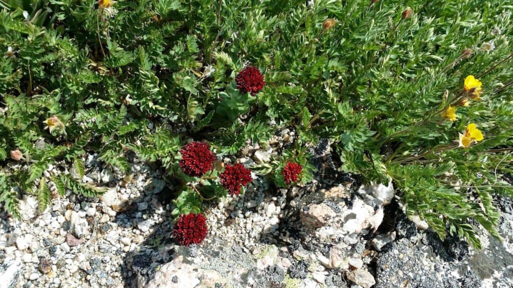
Depending on the type of year you can also see beautiful and colorful wildflowers.
Visiting With Kids
Kids will enjoy a visit to Mount Blue Sky also, and it’s especially convenient for parents since you can easily drive up. Seeing the wildlife is always extra fun for kiddos. The Nature Center exhibits on the way up are also great for kids!
Make sure you keep them close so they don’t tumble off anywhere, watch them for effects of the altitude, and make sure they know to give animals enough space.
We’d highly recommend Mount Blue Sky as an adventure for the whole family.
Other Colorado Mountains
If you are looking for another Colorado mountain that you can drive up by car, make sure to visit Pikes Peak!
If you’re looking to challenge yourself with a climb, you could climb Mount Blue Sky or climb Pikes Peak, but you have many Colorado 14ers to choose from. Kevin climbed Mount Bierstadt as it’s another one of the easier peaks to start with.
What’s Next?
Make sure to spend some time in the town of Idaho Springs. If you have some additional time, learn about the Colorado Gold rush by taking a gold mine tour. If you’re feeling even more adventurous, you can go whitewater rafting!