St. Mary’s Glacier – A Steep But Rewarding Hike
My cousin recommended this hike to us and now we’d like to recommend it to you! In fact it’s one think is an absolute must do in the area.
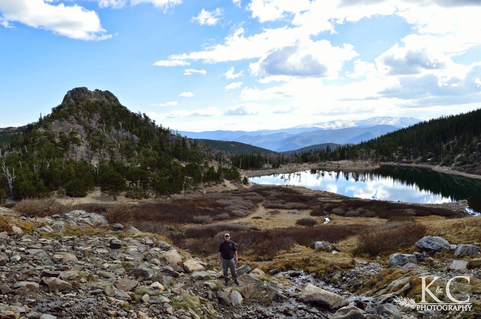
A rocky incline up to the lake rewards you with pretty views. It’s worth hanging out here for a bit and we actually had to give ourselves a little kick to get moving on the rest of the hike!
Spoiler alert, the “glacier” is really a snowfield, but you can walk it all the way to the top and some truly stunning high alpine terrain. You’ll be up by the Continental Divide with mountain views all around you.
DISCLAIMER: Never Stop Adventuring contains links to affiliate websites and is a member of the Amazon Services LLC Associates Program. When you click on and/or make a purchase through an affiliate link placed on our website, we may receive a small commission or other form of compensation at no additional cost to you. Please read our disclaimer for more info.
Hiking To The Lake
The first part of the trail is a pretty short hike up to where the snowfield terminates at the lake. It’s only 3/4 of a mile, but uphill and rocky.
Keep left at the forks to continue uphill until you reach the lake. This really is a beautiful area and easy to linger at.


Continuing up to the right of the lake, we crossed a bridge and then checked out the river running out from the snowfield down toward the lake.
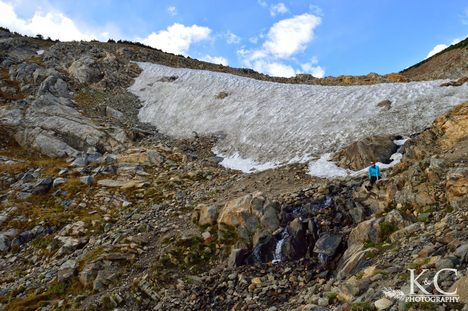
Hiking The Snowfield
We then started up the trail headed toward the top of the snowfield. I will say that at times it felt like an unending slog up the snowfield because when you were in the middle of it you couldn’t tell how much further you had to go.
With only boots and no extra traction devices on our footwear, we sometimes felt like each step wasn’t as efficient as we’d have liked it to be!


Originally we didn’t know how far up we wanted to go, only that we’d turn around when we felt like it. We were feeling good though and the weather was gorgeous, so we planned to at least get to the top of the snowfield and see what was up there.
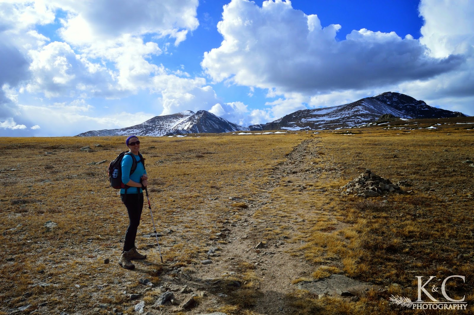
What’s At The Top of St. Mary’s Glacier?
It turns out you come out into high alpine meadows, with other hills and mountains rising around you. It was really spectacular, like take your breath away kind of views all the way around. It’s the kind of place you twirl around, The Hills Are Alive / Sound of Music style.
Up there you can see James Peak and Mount Bancroft ahead, as well as Grays and Torreys, and to the left Mount Blue Sky and Mount Bierstadt in the distance.


St. Mary’s Glacier Trail Basics
Who: Nice short hike and good for most people but be aware that it is uphill and choose how far you will go based on your ability.
What: A 3/4 mile hike to the lake and bottom of the “glacier”, which is actually just a permanent snowfield, longer if you want to hike further up.
Where: Less than an hour drive from Denver, near Idaho Springs. Not far from here is another hike with similar gorgeous views up top at Butler Gulch.
When: It sounds like this can be a year-round destination. Skiers and snowboarders come out to the snowfield year-round and in fact we saw a few skiers ourselves. Be aware of avalanche danger.
Why: Take an enjoyable hike to St. Mary’s Lake and to St. Mary’s Glacier or up further to open meadows with mountain views.
How: To get to the St. Mary’s Glacier trailhead from Denver, head west on I-70 and take exit 238 and drive north on Fall River Road. About 9 miles up there will be paid parking lots on the left both before and after the trailhead. Make sure to only park in the designated lots and to pay the $20 fee.